
Click on the Observatory site to obtain the RFI information
Other sites included :-
Molonglo
Hobart
Ceduna
Tidbinbilla
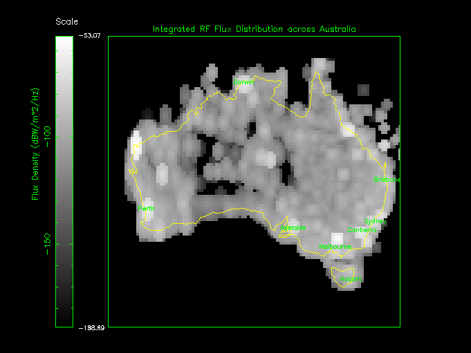
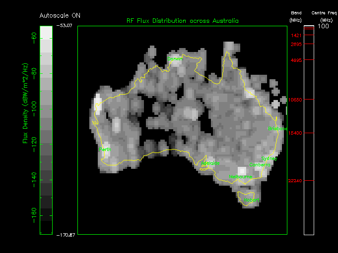
Integrated RF Flux Distribution map for Australia (100 MHz - 10 GHz) (Gray Scale)
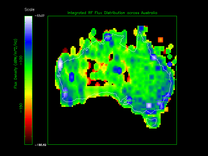
Integrated RF Flux Distribution map for Australia (100 MHz - 10 GHz) (False Colour)
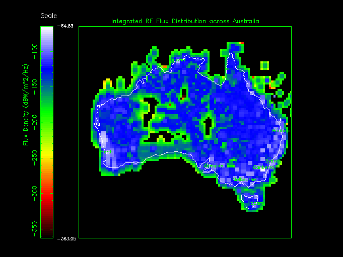
Integrated RF Flux Distribution map for Australia with TRANSHORIZON PROPAGATION LOSS (100 MHz - 10 GHz) (False Colour)
RF Flux Distribution for Australia from 100 MHz - 10 GHz (1.1 Mb animated GIF in GRAY SCALE)
RF Flux Distribution for Australia from 100 MHz - 10 GHz (1.4 Mb animated GIF in FALSE COLOUR)
RF Flux Distribution for Australia from 100 MHz - 10 GHz with TRANSHORIZON PROPAGATION LOSS (1.4 Mb animated GIF in FALSE COLOUR)
Terrestrial interference characteristics were obtained from the Australian Communications Authority (ACA) database. This is a comprehensive listing of all radio licences for the entire Australian continent. It should be noted, that the database is a listing of radio licences only, and that individual licence listings may not necessarily co-incide with actual transmitters. That is, licences may have been granted but the transmitters may not be in place as yet. Also, the transmitters may not necessarily operate continuously. Since this information is not provided, worst-case scenarios are assumed, where the licences co-incide with actual continuously operating transmitters.
The characterisation zone is approx. 200 km centred on the chosen sites - a realistic boundary given natural terrain shielding effects at ATNF observatories and Earth curvature.
Worst-case interference flux density plots are presented for the entire spectrum and for each receiver band. Flux densities are computed in one of two ways. If an effective radiated power is available, it is used as a starting point assuming, in effect, that a directional antenna has its maximum gain in the direction of the Observatory, thereby giving a "worst case" flux density. If no antenna information is listed, it is assumed that the transmitter output power is radiated by an isotropic source. In both cases, the simplest possible propagation model is used, corresponding to a flat earth with no terrain shielding effects.
For illustrative purposes, second and third harmonic radiation from licenced transmitters are also presented. When harmonic levels are plotted, it is assumed that emission levels with respect to the carrier are at levels of -40 dB and -60 dB for second and third harmonics respectively.
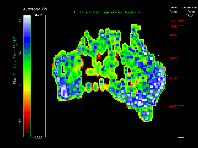
The geographical distribution of terrestrial interferers is presented for each site. Clusters corresponding to cities and towns are obvious, as are some features such as roads and railway lines.
Satellite RFI is also included for both Low Earth Orbit (LEO) and Geostationary (GEO) satellites. For various security and commercial reasons, information on many satellites is classified and unobtainable. For this reason the satellite information is unavoidingly incomplete. However, every effort has been made to catalogue the satellite downlinks that have the potential to interfere with radio astronomy observations. Satellite launches and/or failures, are continually being monitored and the database is updated periodically in order to provide as accurate a database as is possible. To see the satellite frequency database click here. For information on the form of the satellite plots, see the paper produced by Hall, Mohan and Soretz (Proc. URSI Large Telescope Working Group, Sydney, December 1997). Click here to see it.
An Interactive Interference Characterisation program: INTER, has been developed to allow users to identify sources of RFI interactively. To access the program, login to any one of the SUN Ultra-1 workstations at any of the ATNF sites, then type "inter". To more effectively use the package, click here to access the INTER users guide (NOTE: it is a postscript document).
Measured interference plots will also be made available for each site.
Observers should be aware that certain commercial (non-astronomical) bands, encroach very close to those bands reserved for astronomical use, and may cause severe RFI. A listing of these bands should be consulted before attempting non-standard observations. Click here to obtain a listing of these bands.
For a full listing of the Radio Astronomy Reserved Bands Click here.
Links to other RFI web sites:-
Green Bank Observatory 'Quiet Zone'. Select 'Quiet Zone' or RFI.
Puerto Rican Co-ordination Zone (Arecibo Observatory).
VLA RFI (NRAO page)
Georgia Tech HRMS RFI Search (HRS)